Photos of Kilimanjaro - Rongai Route Pictures
These Photos of Mount Kilimanjaro take you along the Rongai route.
You can follow the Rongai trail, from the Nale Moru village via the Mawenzi Tarn to Kili's summit, Uhuru peak.
This trek usually takes six day and has a very high success rate.
Some operators also offer a five day version, but if you want to see Uhuru Peak, I don't recommend it.
(Read in detail about climbing Kilimanjaro on the Rongai route.)
Photos of Kilimanjaro: 1-6
Rongai Route, Day 1 and 2
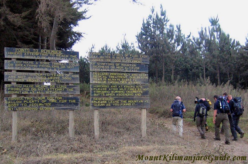 The trail head of the Rongai Route.
The trail head of the Rongai Route is in the Nale Moru village, a two to three hour drive from Marangu.
Initially you wander through somewhat bleak plantation forest, but it soon gives way to montane forest and moorland.
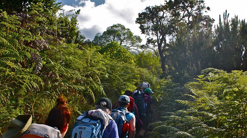 Montane Forest on day 1 of the Rongai Route, photo by Kyle Taylor.
Day one is only a very short day.
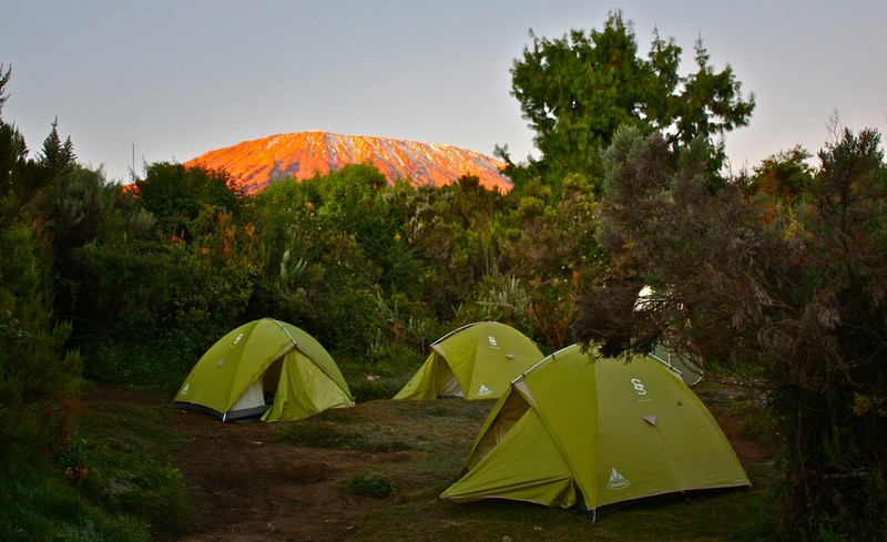 The first camp on the Rongai Route, photo by Kyle Taylor.
The camp (at "First Cave Campsite") is usually busy, and so is the lunch stop the next day, at the Second Cave Camp...
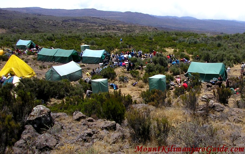 Mess tents of several groups are set up for a hot lunch at Second Cave Camp.
Luckily, after lunch most groups will go in different directions. There are several variations to the Rongai route, from 5 to 7 days.
On this six day trek you turn south east and start hiking towards Mawenzi. For most of the day you will have beautiful views of Kibo and its eastern icefields...
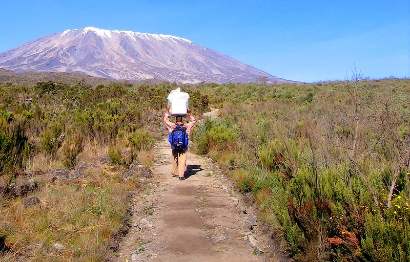 Porter on the Rongai Route, looking at the eastern icefields of Kilimanjaro, photo by Calumr.
...and of course of the jagged spires of Mawenzi...
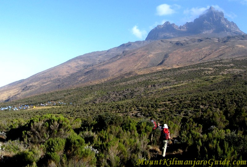 Approaching Kikelewa Caves Camp with Mawenzi in the background.
The first people will start to feel the altitude. This has been a long day and you may be very glad to see that campsite.
Photos of Kilimanjaro: 7-9
Rongai Route, Day 3
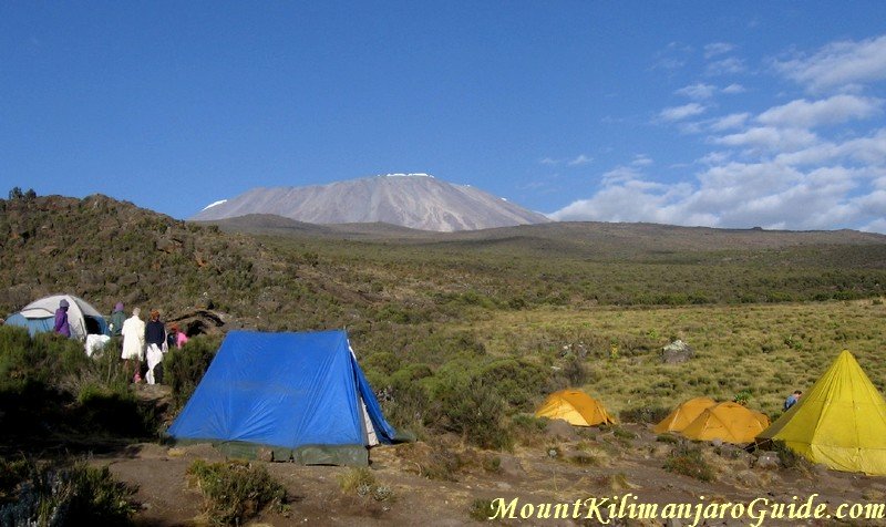 Early morning view of Kilimanjaro from Kikelewa Caves Camp.
On day three you awake to beautiful views of Kibo, but even though Kibo is your final destination, you will leave it behind for a while as you make your way to the Mawenzi Tarn Camp.
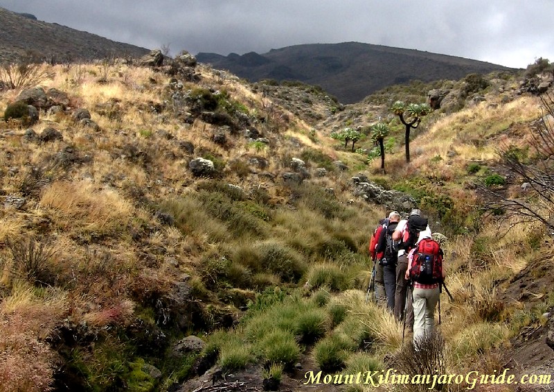 Charred senecios are slowly coming back to life.
This area used to be full of the giant senecios, but a fire had destroyed many of them on this side of the mountain. Only a few are resprouting at the top.
As you continue on your way towards Mawenzi the landscape is becoming harsher and rockier and soon the vegetation disappears altogether.
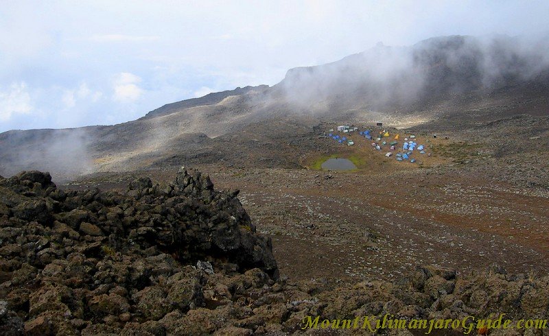 The Mawenzi Tarn Camp, viewed from above.
The Mawenzi Tarn Camp is in a stunning location, in a protected hollow right underneath the main tower of Mawenzi. You'll be reaching it in time for lunch.
In the afternoon you can go on an acclimatization walk up the ridges and spires of Mawenzi (which is where the above photo was taken from).
Photos of Kilimanjaro: 10-17
Rongai Route, Day 4
The Mawenzi Tarn Camp is at 4330 m (14210 ft) and it's bitter cold at night. Even the little tarn freezes over. But as soon as the sun comes up the temperatures are bearable again, warm enough to have breakfast in the open.
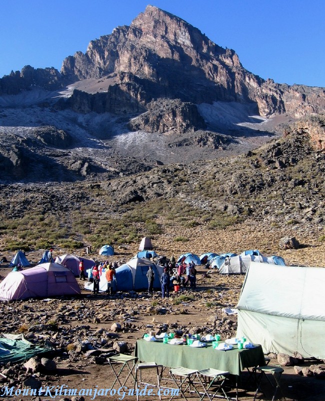 The table is set for breakfast beneath Mawenzi peak.
After breakfast you will finally change directions again. Well acclimatized you head towards the Kibo Huts, which are only 370 m (1215 ft) higher than last nights camp.
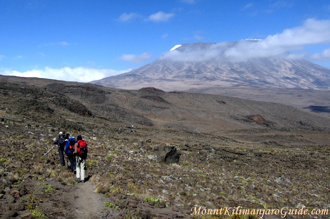 Heading towards the Kibo Huts.
The day is spent crossing the beautifully barren and windswept plain of alpine desert between Mawenzi and Kibo, called "the saddle".
As usual, the early morning views are clear. But that often changes all too quickly. Here the clouds are rolling in, in front of the climbers...
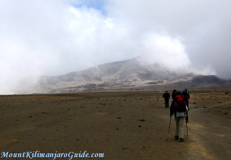 Kilimanjaro climbers making their way across the saddle.
...and behind them...
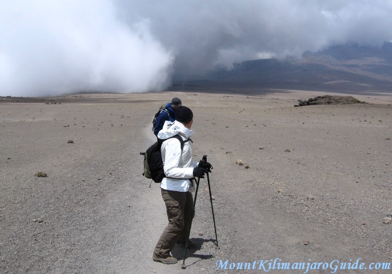 Clouds rolling across the saddle.
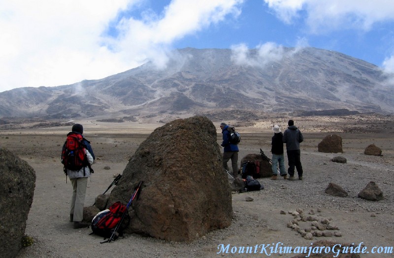 Having a last break before reaching the Kibo Huts.
From the last rest point amongst the boulders it's not too far until the little Rongai trail meets the wide beaten main path of the Marangu route.
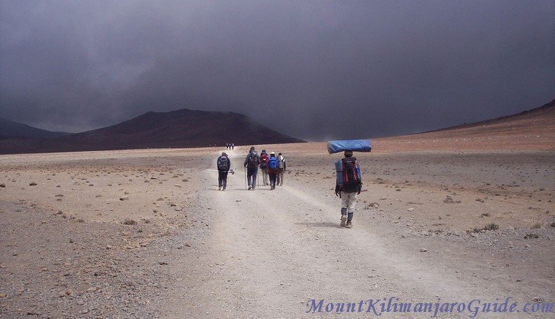 After the Rongai trail joins the Marangu route.
And not far beyond the junction you finally reach the Kibo Huts, your last camp before your summit bid.
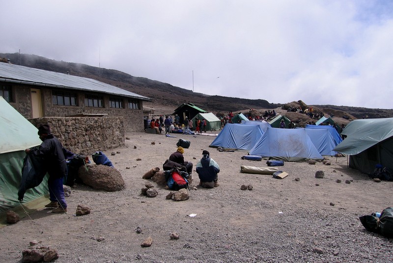 Kibo Huts, Mt. Kilimanjaro, photo by Calumr.
You are now at 4700 m/15320 ft and you'll be feeling the altitude.
The Kibo Huts are made from stone. And they are cold!!! Your tents are much warmer. True. It's easier to heat a little tent with your body than it is to heat a big stone hut with many bodies.
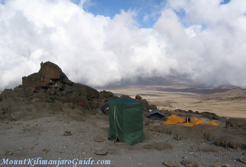 The view from the Kibo Huts Camp.
The Kibo Huts are not the most picturesque camp on the mountain, but you camp below them. And if you turn your back to them, the view across the saddle is beautiful. On top of that you avoid staring at the challenge that lies ahead in only a few hours...
(Center stage in this Kilimanjaro photo is taken by the toilet tent. Some tour operators will spare you the experience of the Kilimanjaro toilets. Others say it's all part of the experience.)
Photos of Kilimanjaro: 18-22
Rongai Route, Day 5
You will be setting out on your trek to the summit some time around midnight. The way to the rim is an endless succession of switchbacks on a steep scree slope but you won't be seeing any of it. You'll just see the little circle of light from your head torch, your feet, and the feet of the person in front of you. Until the break of dawn, that is...
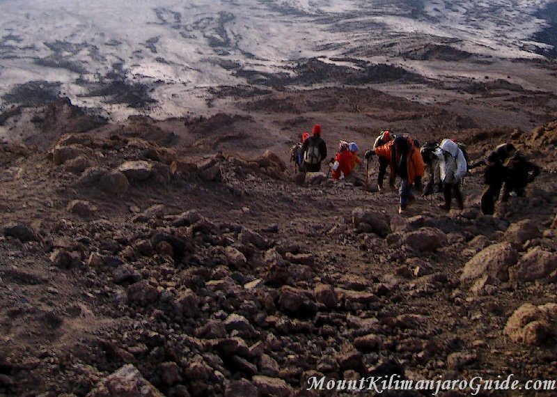 The first daylight. Climbers and guides on the last metres to the Kilimanjaro crater rim.
Some people manage to make it to Uhuru Peak in time for the sunrise, but you can see the sunrise from any point on the crater rim or even on the way up. No need to rush...
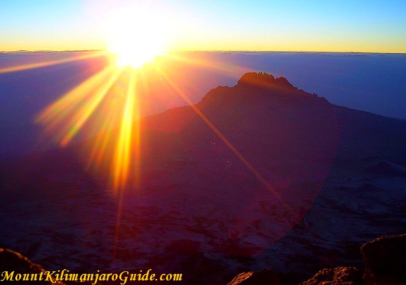 The sunrise viewed from Gilman's Point, with Mawenzi in the distance.
This is what a sunrise on Kilimanjaro looks like if you view it from Gilman's Point, the point where you will be reaching the crater rim.
And this is what two happy climbers at Gilman's Point look like, squinting into the rising sun...
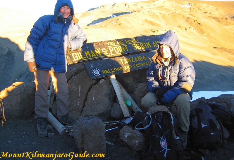 Gilman's Point, Kilimanjaro, 5681 m/18640 ft
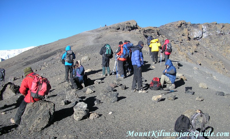 Group resting at Gilman's Point on the Kilimanjaro crater rim.
If you make it to Gilman's Point the park authorities will reward you with a certificate for climbing Kilimanjaro. And for some people the temptation to turn around now is too big...
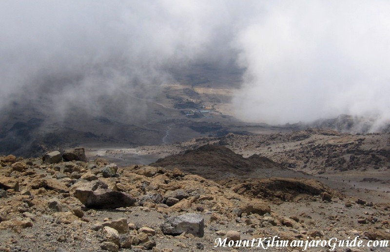 View down to the Kibo Huts from Gilman's Point.
This is the way back down to the Kibo Huts, seen from Gilman's Point. The summit path is so steep, you can't even see it any more.
But I hope you won't think about turning back now!
To continue to Uhuru Peak from here allow another one and a half to two hours, three hours for the round trip.
For many people the walk along the Kilimanjaro crater rim is the best part of the whole experience, and this is the part where you will be passing what's left of Kilimanjaro's glaciers.
Next: Reaching the summit of Kilimanjaro
Read a detailed description of the Rongai route
Do you need help with all this?
Would you like to contact a responsible and trustworthy tour operator with competitive prices?
Get some free, no obligations advice on route selection, duration and timing?
I regularly receive emails asking me if there is a tour operator I personally can recommend.
There is and you can contact my preferred operator through this page.