Mount Kilimanjaro Pictures - Photos of the Marangu Route
These Mount Kilimanjaro Pictures take you along the Marangu route.
You can follow the Marangu trail, from the Marangu gate to Kili's summit, Uhuru peak.
This trek takes at least five days, but if you want to actually make it to the summit, take the offer of an additional acclimatization day, and make it six!
(Read in detail about climbing Kilimanjaro on the Marangu route.)
Mount Kilimanjaro Pictures 1
Marangu Village, Kilasiya Falls
The small village of Marangu is located on the lower slopes of Mount Kilimanjaro. The fertile fields are irrigated by streams that are fed by Mt. Kilimanjaro's glaciers.
One of those streams tumbles over a cliff face into a deep, narrow gorge: the Kilasiya Falls.
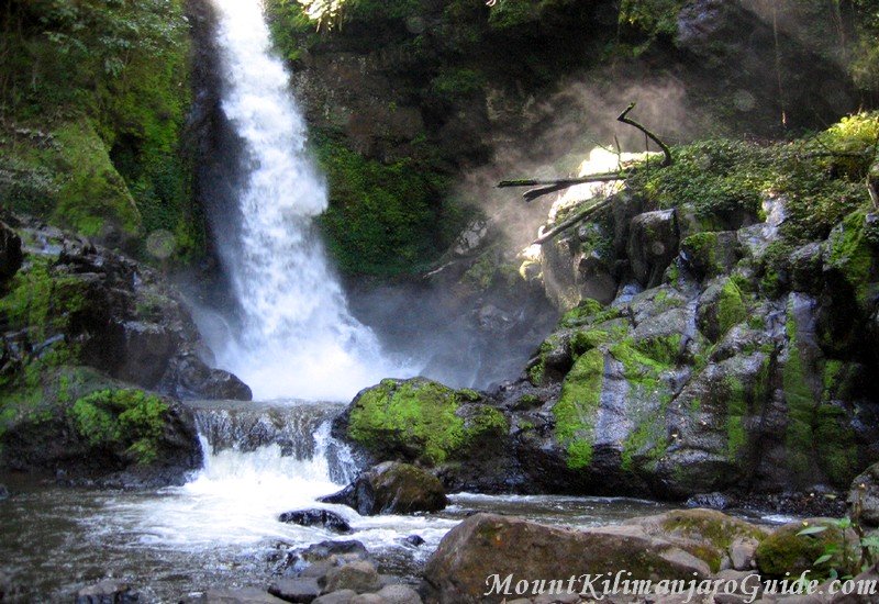 Kilasiya Falls, Marangu, Kilimanjaro Foot Hills.
The Kilasiya Falls are located in Marangu Village, and you will only get a chance to visit them if you arrive a day or two early, or spend another day here after your climb.
But most people who climb Kilimanjaro on the Marangu route arrive in the evening, and start climbing the next morning...
Mount Kilimanjaro Pictures 2-5
Marangu Route, Day 1
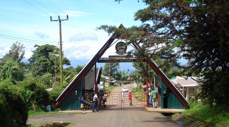 Marangu Gate, Mount Kilimanjaro, photo by Marc van der Chijs.
After entering Mount Kilimanjaro National Park at Marangu Gate you will complete the registration formalities at the park headquarters. Once that is done you are on your way...
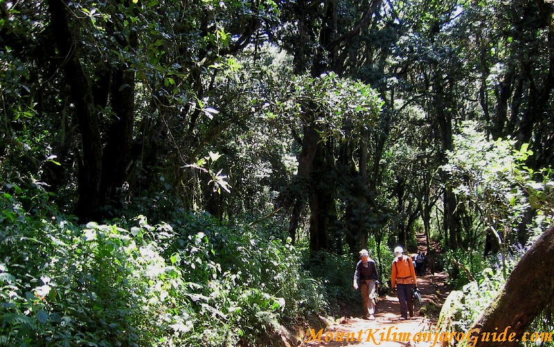 At the start of the Marangu trail.
The first day of the climb on the Marangu route leads through dense rainforest.
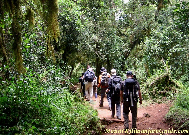 The rainforest on Mount Kilimanjaro.
Your first overnight stop will be at the Mandara Huts.
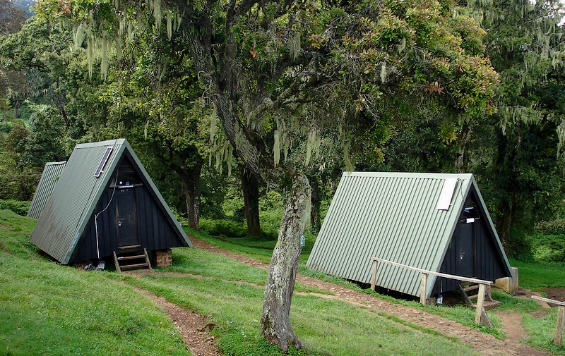 Mandara Huts, photo by Marc van der Chijs.
You are now at 2700 m/8860 ft and tomorrow the vegetation will start to open up.
Mount Kilimanjaro Pictures 6-9
Marangu Route, Day 2
Once you leave the Mandara Huts there is a last patch of forest, called the "monkey forest".
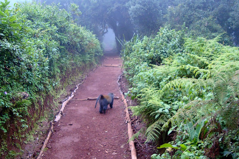 Monkey on the Marangu Trail, photo by Marc van der Chijs.
But these are the last trees, and you now enter the Moorland zone where giant heather rules:
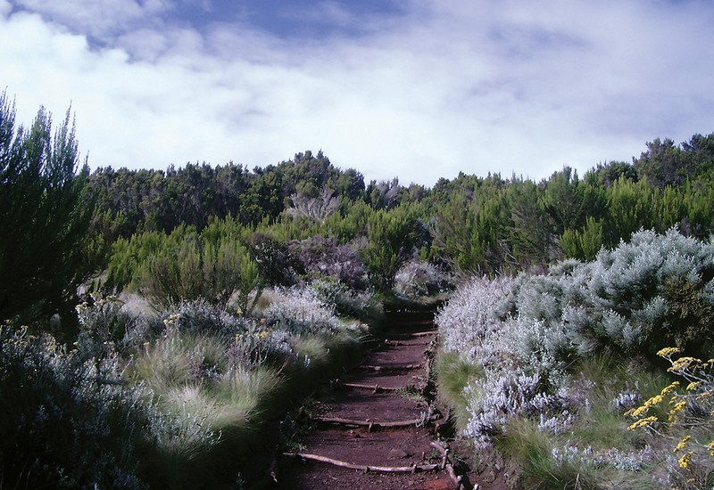 The Moorland, the second vegetation zone on Mount Kilimanjaro, photo by El Toñio.
Day two ends at the Horombo Huts at 3700 m/12140 ft. And the giant heather is not so giant anymore. Oxygen is getting less and life is getting harder, for the plants as well as for the climbers.
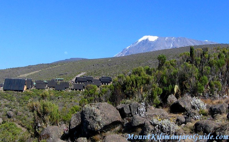 Arriving at the Horombo Huts with Kibo in the background.
If you are taking the extra acclimatization day, you'll be staying here for two nights.
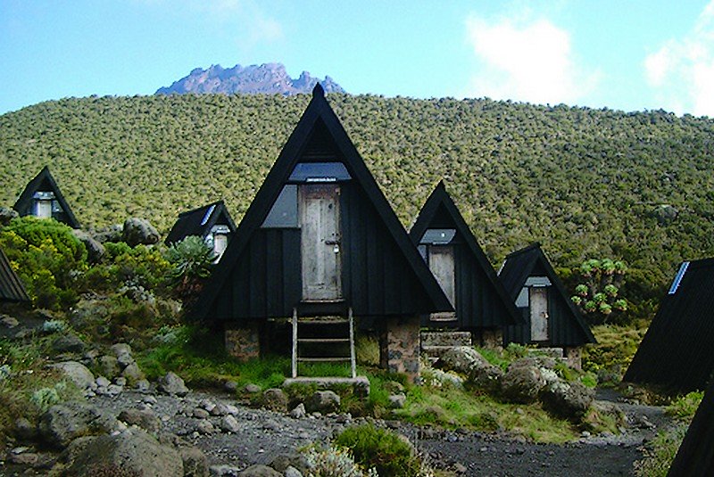 Horombo Huts, Mt. Kilimanjaro, photo by El Toñio.
The peak behind the huts is Mawenzi, Kilimanjaro's second peak. The acclimatization walk leads towards it. Then you turn around to sleep at Horombo Huts again.
When you wake up you'll continue your walk towards Kibo...
Mount Kilimanjaro Pictures 10-13
Marangu Route, Day 3 or 4
After climbing through a bit more heather you reach the saddle between Mawenzi and Kibo.
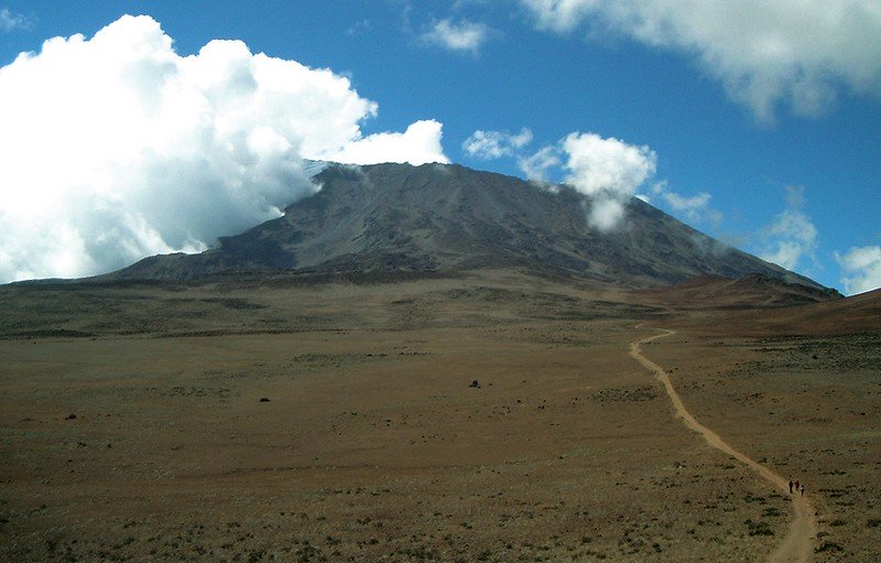 The Saddle of Kilimanjaro, photo by El Toñio.
And the alpine desert. Rocks and dust, and dust and rocks, that's all that is left.
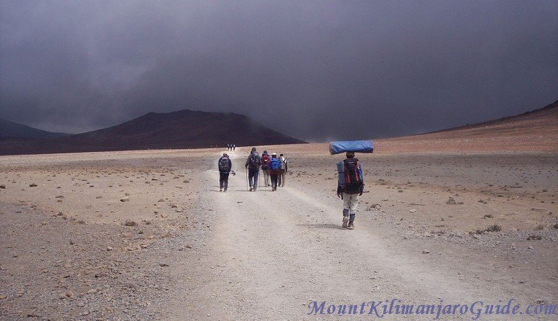 Climbers and porters hiking in the alpine desert zone on Klimanjaro.
After 5-7 hours of walking time you reach the destination for your last night before your summit bid, the Kibo Huts.
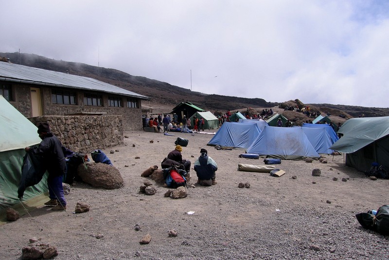 Kibo Huts Camp, Mt. Kilimanjaro, photo by Calumr.
The Kibo Huts are made from stone. And they are cold!!! If you wonder what the tents are doing there, that are the tents of the climbers from the Rongai route. They also use the Kibo Huts as their last camp.
The Kibo Huts are not the most picturesque camp on the mountain. But at this point picturesqe is not what you're after. You are now at 4700 m/15320 ft and you'll be feeling the altitude. On top of that you'll have a very good view of the challenge that lies ahead in only a few hours...
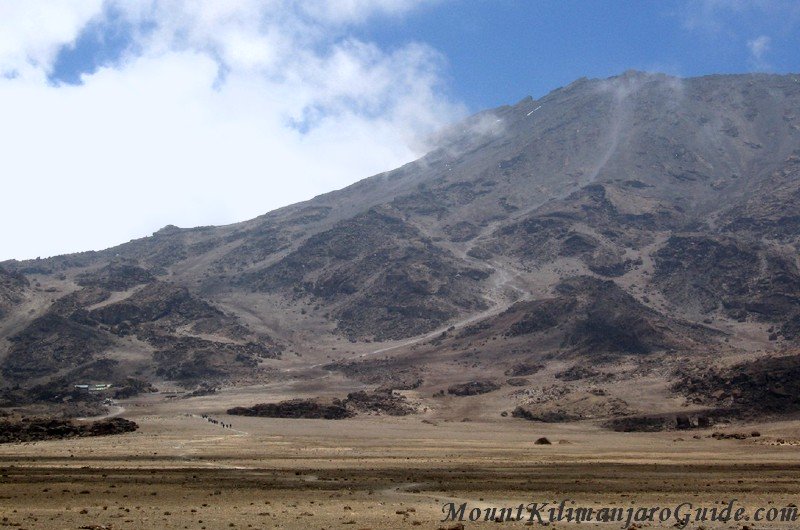 The Kilimanjaro summit path behind Kibo Huts
You looked at it all day while walking towards the Kibo Huts (which you can spot on the left edge of the photo): Kibo, the main peak of Kilimanjaro. And you will start dragging your weary bones up that path that you see in the middle, sooner than you might like...
Mount Kilimanjaro Pictures 14-19
Marangu Route, Day 4 or 5
You will be setting out on your trek to the summit some time around midnight.
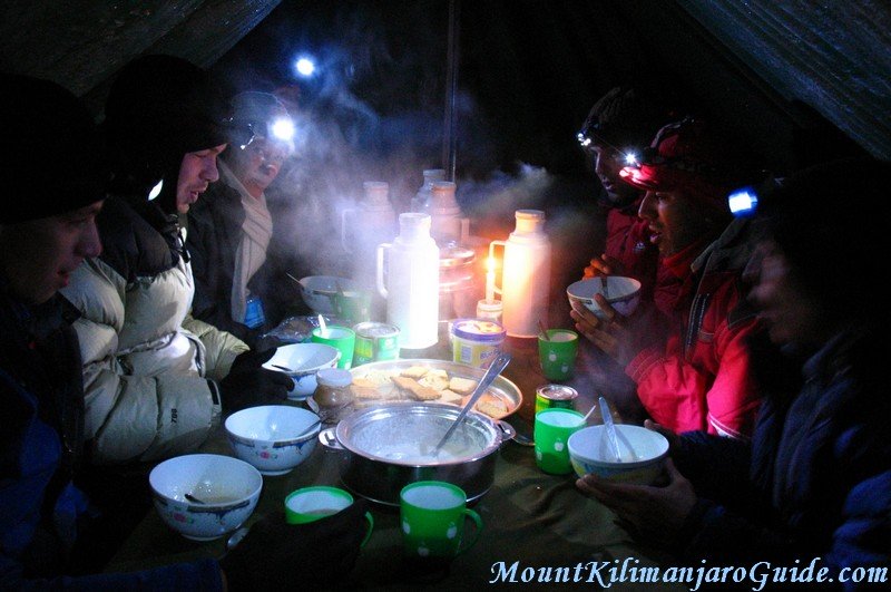 A chilly breakfast on summit day.
The way to the rim is an endless succession of switchbacks on a steep
scree slope, but you won't be seeing any of it. You'll just see the
little circle of light from your head torch, your feet, and the feet of
the person in front of you. Until the break of dawn, that is...
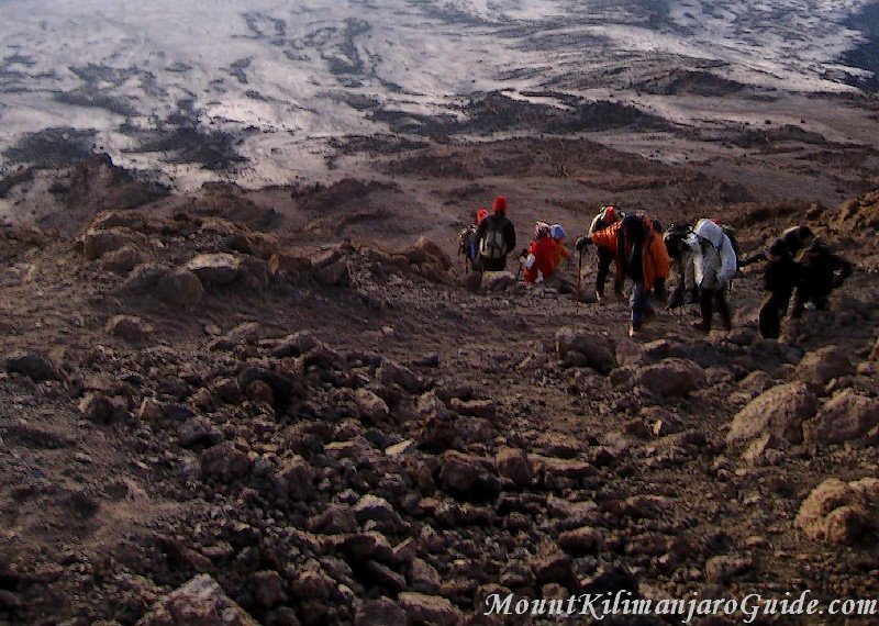 Climbers and guides on the last metres to the Kilimanjaro crater rim.
Some people manage to make it to Uhuru Peak in time for the sunrise, but you can see the sunrise from any point on the crater rim or even on the way up. No need to rush...
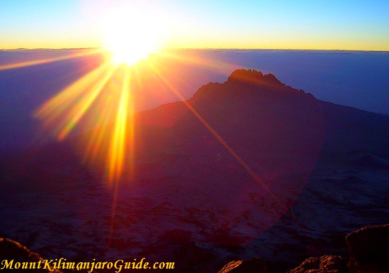 The sunrise viewed from Gilman's Point, with Mawenzi in the distance.
This is what a sunrise on Kilimanjaro looks like if you view it from Gilman's Point, the point where you will be reaching the crater rim.
And this is what two happy climbers at Gilman's Point look like, squinting into the rising sun...
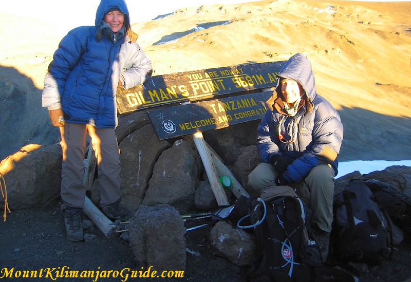 Gilman's Point, Kilimanjaro, 5681 m/18640 ft
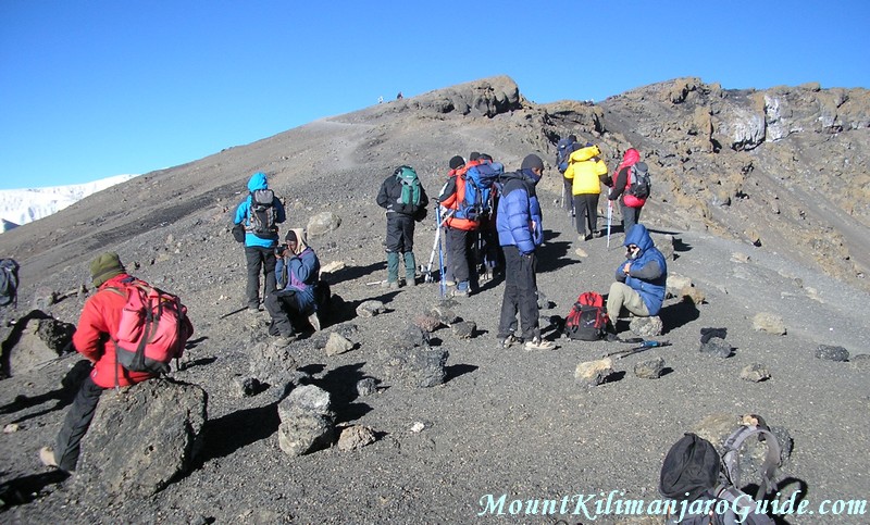 Group resting at Gilman's Point on the Kilimanjaro crater rim.
If you make it to Gilman's Point the park authorities will reward you with a certificate for climbing Kilimanjaro. And for some people the temptation to turn around now is too big...
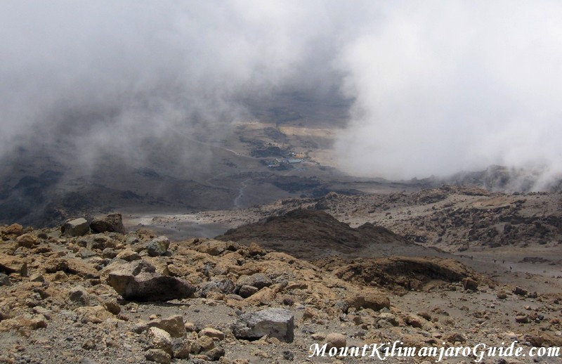 View down to the Kibo Huts from Gilman's Point.
This is the way back down to the Kibo Huts, seen from Gilman's Point. The summit path is so steep, you can't even see it any more...
But I hope you won't think about turning back now!
To continue to Uhuru Peak from here allow another one and a half to two hours, three hours for the round trip.
For many people the walk along the Kilimanjaro crater rim is the best part of the whole experience, and this is the part where you will be passing what's left of Kilimanjaro's glaciers. (See Kilimanjaro Summit.)
Next: Machame Route Pictures
Read a detailed description of the Marangu route
Do you need help with all this?
Would you like to contact a responsible and trustworthy tour operator with competitive prices?
Get some free, no obligations advice on route selection, duration and timing?
I regularly receive emails asking me if there is a tour operator I personally can recommend.
There is and you can contact my preferred operator through this page.
Return to Mount Kilimanjaro Photo Gallery